
Smart Agriculture

Field & Crop Monitoring System

Satellite imagery and photos from the field catch disease early, and spraying and harvest planning are shown in the grower's own terms.

Early detection: 12 days sooner · Chemical saving: 82%
Field & Crop Monitoring System

Müşteri: Agricultural Production & Contract Farming Union (1,450 decares)

01

The problem

Across large fields, leaf diseases such as yellow rust, septoria and mildew had usually spread through the whole plot by the time anyone saw them by eye. That meant spraying the entire field and still losing yield. And because pre-harvest yield was estimated by eye, storage and contract sales planning never held up.

02

The architecture we built

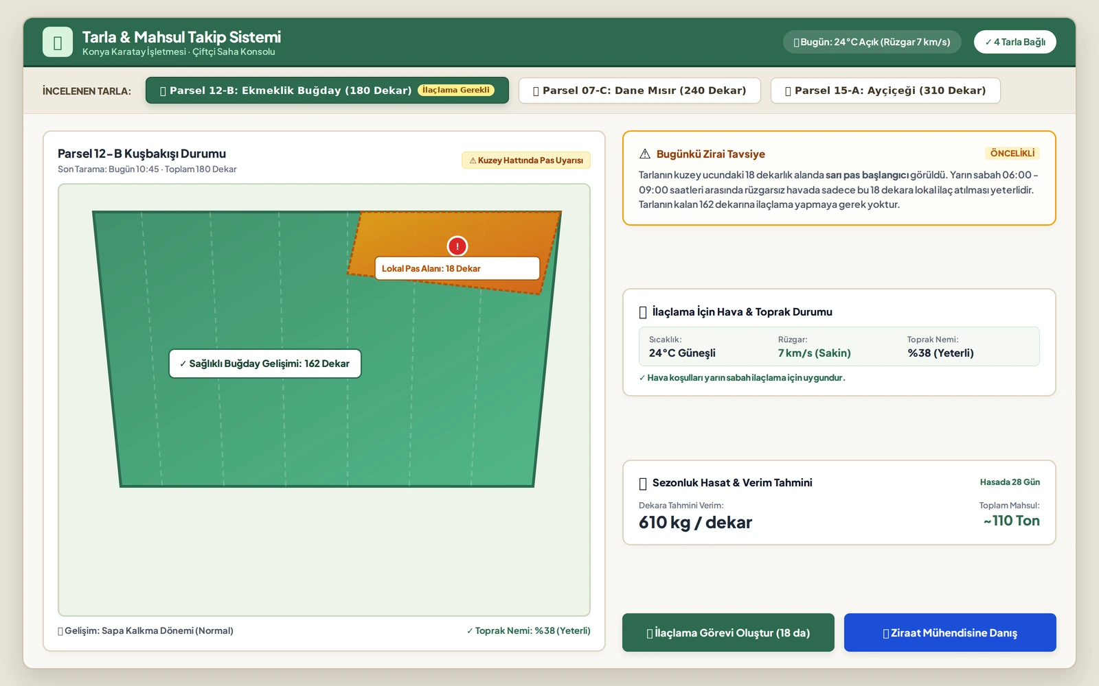
The state of the field is brought together from three sources. Weekly satellite check: the greenness and growth of every plot is mapped once a week from satellite imagery, and areas that stand out from their neighbours are flagged. Disease detection from a photo: a leaf photo taken with a phone or a drone on a flagged plot is checked by the system, which names the disease with 96% accuracy. Yield forecast: soil moisture, rainfall and the growth stage of the crop are weighed together, and the harvest estimate is kept up to date.

03

The outcome

Disease was caught while the first spots were appearing - on average 12 days earlier. Only the 18 decares that were actually infected were sprayed instead of the whole field, cutting chemical costs by 82%. The harvest estimate held to 94% accuracy, which made storage and contract sales planning safe.

Early detection: 12 days sooner · Chemical saving: 82%

Facing a similar bottleneck? Let's review your process together in 15 minutes.

Keşif görüşmesi talep edin

← All case studies